
Context
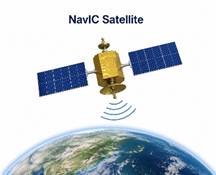
The Government informed Parliament that NavIC can no longer independently provide standalone positioning services because only three satellites are currently providing Positioning, Navigation and Timing (PNT) services, whereas at least four operational satellites are required.
Explanation
- NavIC (Navigation with Indian Constellation) is India’s regional satellite navigation system, developed by ISRO under the Indian Regional Navigation Satellite System (IRNSS).
- It was designed as a 7-satellite constellation to provide Positioning, Navigation and Timing (PNT) services over India and up to 1,500 km beyond its borders.
- A minimum of four operational satellites is required for standalone positioning; currently, only three satellites are operational for PNT.
- NavIC receivers can still use GPS (USA), Galileo (EU), GLONASS (Russia), and BeiDou (China) in a multi-constellation GNSS environment.
- NVS-series satellites are the second-generation NavIC satellites with improved atomic clocks and enhanced navigation capabilities.
La Excellence IAS Academy, the best IAS coaching in Hyderabad, known for delivering quality content and conceptual clarity for UPSC 2026 preparation.
FOLLOW US ON:
◉ YouTube : https://www.youtube.com/@CivilsPrepTeam
◉ Facebook: https://www.facebook.com/LaExcellenceIAS
◉ Instagram: https://www.instagram.com/laexcellenceiasacademy/
GET IN TOUCH:
Contact us at info@laex.in, https://laex.in/contact-us/
or Call us @ +91 9052 29 2929, +91 9052 99 2929, +91 9154 24 2140
OUR BRANCHES:
Head Office: H No: 1-10-225A, Beside AEVA Fertility Center, Ashok Nagar Extension, VV Giri Nagar, Ashok Nagar, Hyderabad, 500020
Madhapur: Flat no: 301, survey no 58-60, Guttala begumpet Madhapur metro pillar: 1524, Rangareddy Hyderabad, Telangana 500081
Bangalore: Plot No: 99, 2nd floor, 80 Feet Road, Beside Poorvika Mobiles, Chandra Layout, Attiguppe, Near Vijaya Nagara, Bengaluru, 560040